 |
| International Date Line |
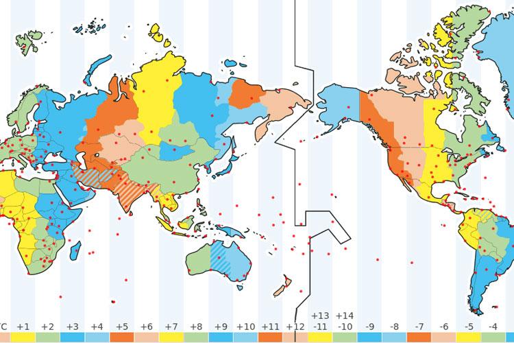
I didn't have a single student who could answer that question. So, we looked at it. Most of my students couldn't tell me how many time zones there are in the world, (24), or why there are 24. So, we spent some time talking about day and night. Hours in a day. Days in a year. In most classes, I used the flashlight from my phone to represent the sun. The earth was rotating on its axis and revolving around it.
I think the students understood, after we worked through it. Either way, count on a bellwork tomorrow that asks questions dealing with time zones, the earth, the sun, and the International Date Line.
After we finished that, we continued working with the Big Maps. We figured out the circumference of the earth at the equator, and at 60° N... And we figured out why their answers were so far off with the 60° N question - even the ones where the students answered correctly. (The farther north you go, the more distorted a flat map becomes...)
Students can earn extra credit by reading and discussing the blog with an adult. To prove that you were here today, discuss with an adult why the International Date Line zig-zags so much. Then, write your answer on a sheet of paper. Have the adult you read and discussed the blog with sign the paper.
Turn it in tomorrow for extra credit. Have a great day.
 |
| Working With the Big Maps |

No comments:
Post a Comment